Nigericeras scotti
- Phylum: Mollusca
- Class: Cephalopoda
- Order: Ammonoidea
- Family: Vascoceratidae
- Genus: Nigericeras
- Species: Nigericeras scotti Cobban, 1972
Geological Range
Nigericeras scotti Zone: Upper Cenomanian 93.32 ± 0.38 to 93.5 ± 0.3
Cenomanian to TuronianPaleogeographic Distribution
New Mexico to Colorado
Remarks
Original presentation: Nigericeras scotti.
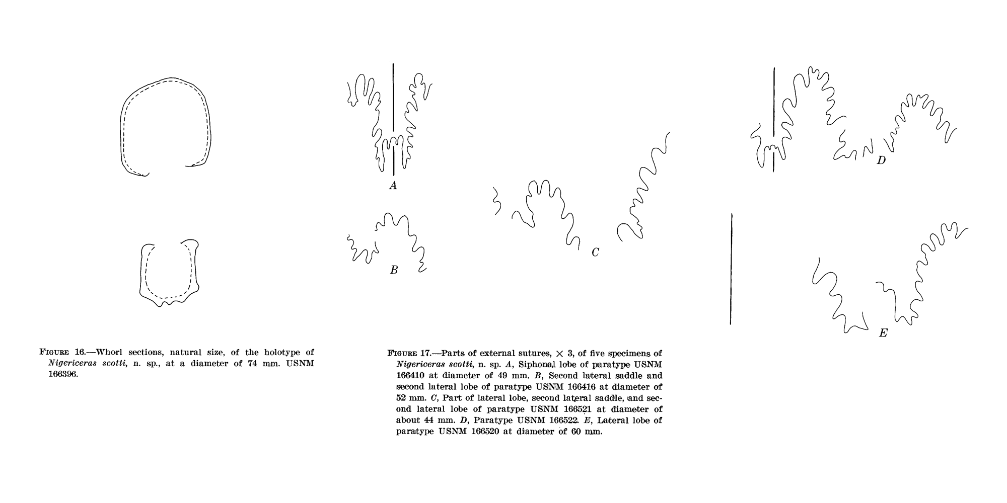
Original publication: Cobban, W. A. 1972. New and little-known ammonites from the Upper Cretaceous (Cenomanian and Turonian) of the Western Interior of the United States. USGS Geological Survey Professional Paper 699, 22 pp.
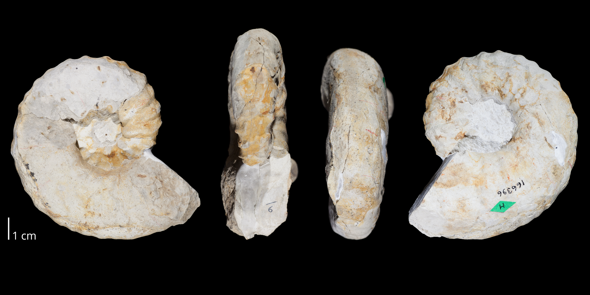
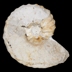
Holotype: USNM 166396.
Type locality: Baca County, Colorado (Cobban, 1972).
Type horizon: Greenhorn Limestone (Bridge Creek Limestone Member) (Cobban, 1972).
Other specimens: USNM 166397-166416, USNM 166517-166522, USNM 164057.
Zonation: Nigericeras scotti zone.
PaleoDB taxon number: 337701.
References: Cobban (1972).
Origin of name: “named for Glenn R. Scott” (Cobban, 1972, p. 20).
Stratigraphic Occurrences
- Turonian
- Greenhorn Limestone (CO)
- Cenomanian
- Colorado Formation (NM)
- Greenhorn Limestone (Bridge Creek Limestone Member) (CO)